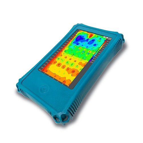
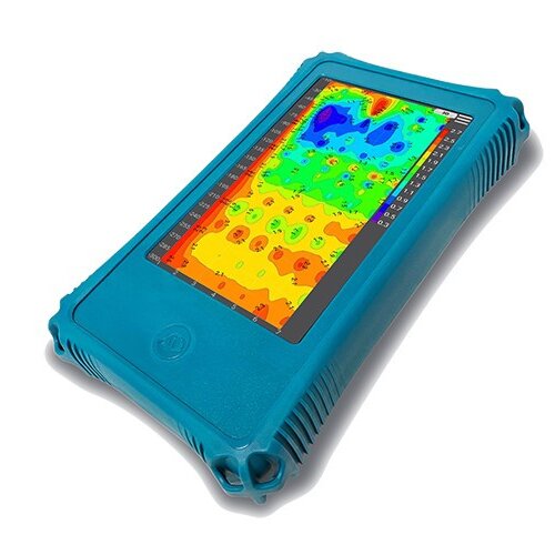

Golden Rod Pro is completely wireless and easy to operate with significantly improved accuracy. It features segmented and multi-density scanning to meet the specific needs of customers. Equipped with AI intelligent analysis, it serves as your 24/7 free online assistant. It can also automatically generate 2D/3D/slice images, providing an intuitive view of underground water sources, mineral resources, and geological structures, making it highly valuable for geological exploration.
 Pro-grade Accuracy
  Segmented Scanning
 Scan Density Options
  AI Analysis
|
Treasure Hunting |
Mineral Exploration |
|
Engineering Investigation |
Environmental Surveys |
Treasure Hunting: Exploration and prospecting for rare minerals such as jade, gemstones, ebony, and crystal
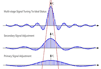 Upgraded Accuracy
The new Golden Rod Pro geophysical detector boasts a meticulously designed multi-stage signal conditioning system, achieving unprecedented measurement accuracy and reliability, underpinning your exploration endeavors.
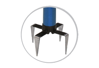 Enhanced Stability
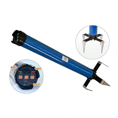
The four-electrode design effectively enhances stability during measurements, ensuring accurate and reliable data
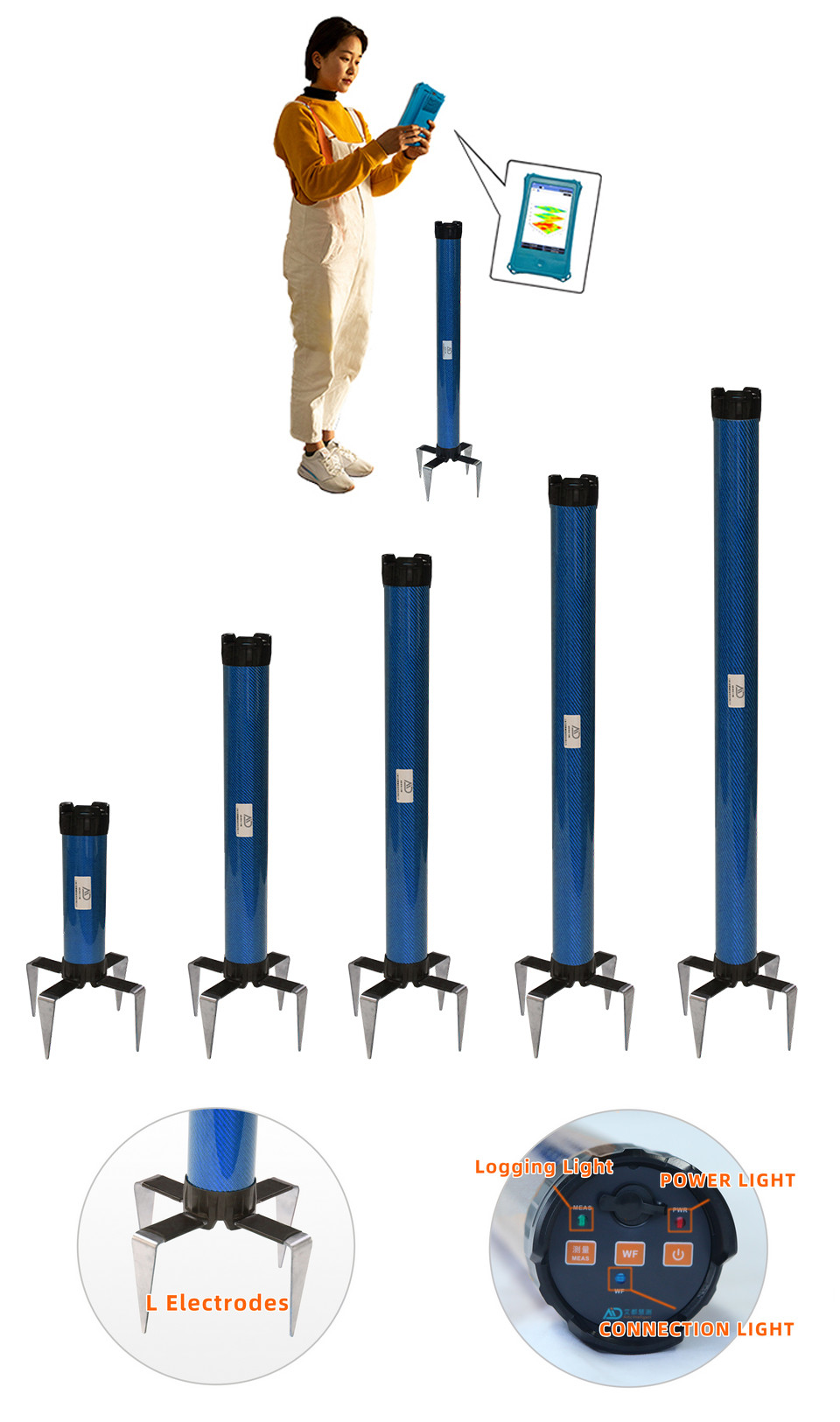
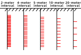 Scan Density Options
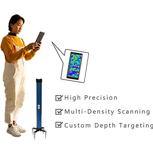
The 1G versions offer two scanning densities: 2-meter interval per layer and 4-meter interval per layer. The 1600 versions provide three options: 5 meters, 10 meters, and 20 meters. Smaller scanning intervals offer higher accuracy, but also require longer measurement times. Users can select the appropriate option based on their needs: for faster results, choose a larger scanning interval; for higher precision, opt for a smaller interval
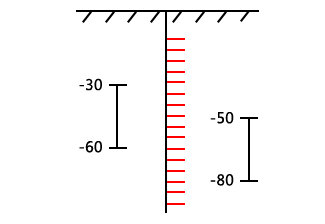 Segmented Measurement
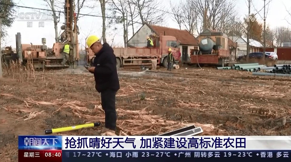
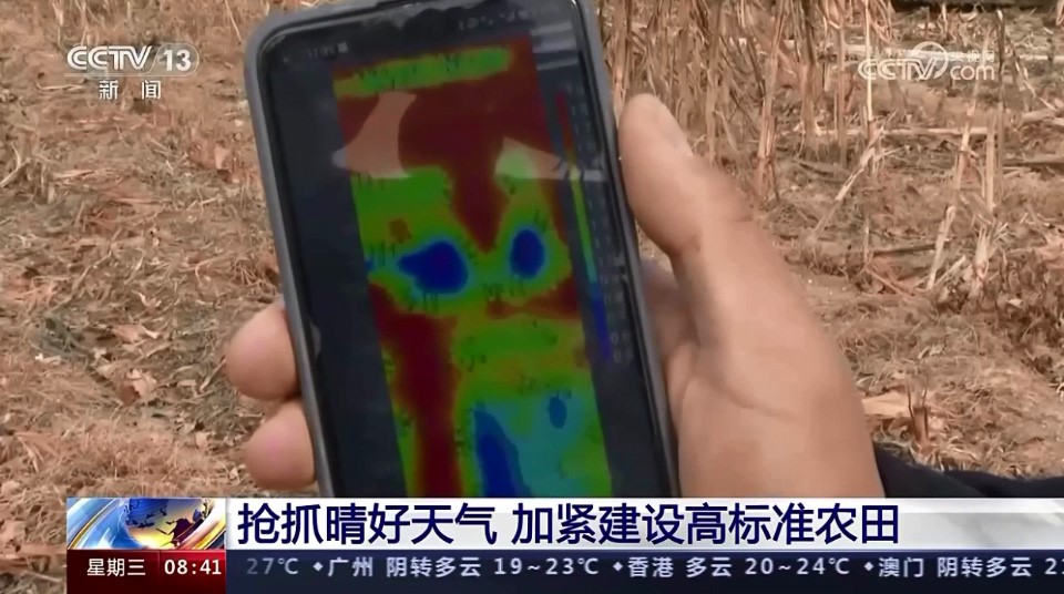
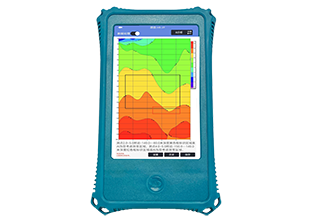
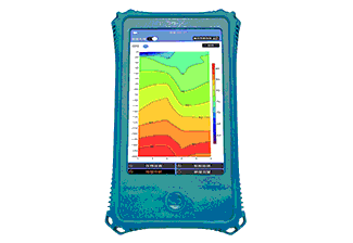 Auto Imaging
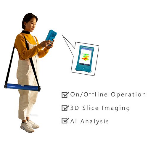
Equipped with the Aidu Measure app, independently developed by AIDU, it can automatically generate 2D/3D/slice images, making analysis more intuitive and allowing for easy location and depth identification of underground mineral bodies
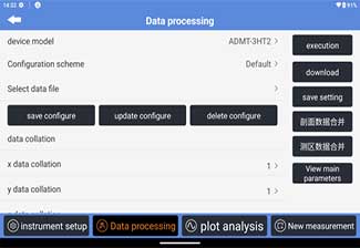 On-Device Data Processing
Without the need for a desktop computer, data denoising, smoothing, and inversion can be easily performed directly on the device. This enhances data accuracy and provides significant convenience for geological surveys and mineral exploration
 24/7 AI-Powered Auto Analysis
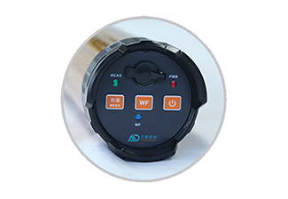 Offline Measurement
Newly introduced offline measurement capability not only enhances user experience but also effectively mitigates the impact of external factors like electromagnetic interference on real-time measurements, resulting in more accurate and reliable outcomes
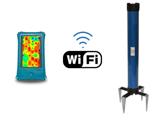 WiFi Networking
The shift to WiFi connectivity has significantly enhanced data transmission efficiency
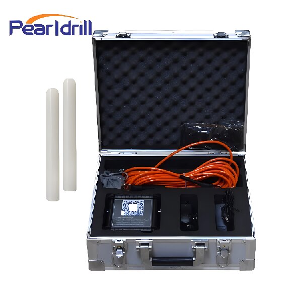
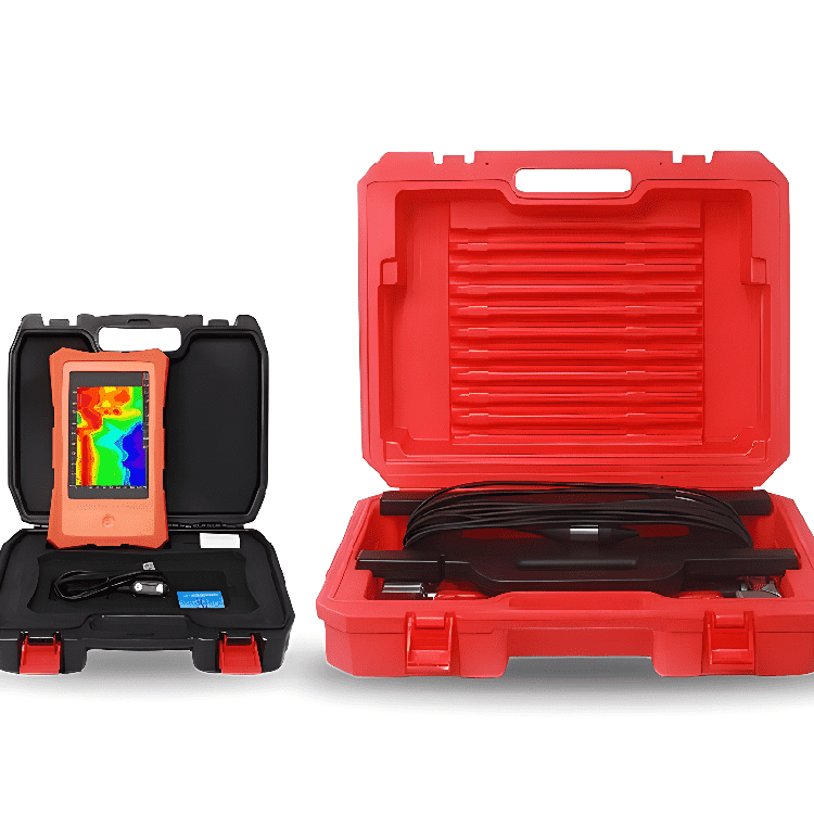
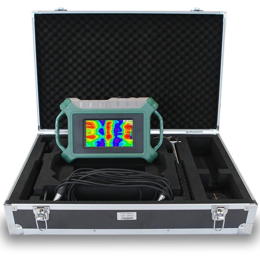
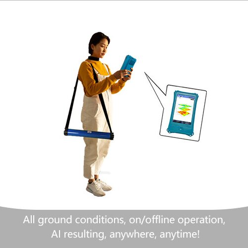
 Wireless Operation
The new generation product inherits the advantages of its predecessor, being completely wireless and easy to operate, allowing for single-person use. It can be used for measurements whether placed on the ground, stood upright, or carried on the back, without being limited by ground conditions. Whether in rugged mountainous terrain or complex urban environments, it can handle the task effectively
|
Versions |
ADMT-1G |
ADMT-1GT2 |
ADMT-1GT3 |
ADMT-1600WT4 |
ADMT-1600WT5 |
|
Max Depth |
100 m |
1600 m |
|||
|
Scan Interval |
2/4 m |
5/10/20 m |
|||
|
Battery |
7.4V 2600mAH lithium battery, Power consumption approx. 140mA |
||||
|
Connection |
WIFI |
||||
|
MN Electrodes |
Four L-shaped alloy electrodes, each with a size of 100*95*30mm |
||||
|
Core Features |
custom depth range targeting, variety of scan density, auto 2D/3D imaging, AI interpretation of image, on/offline operation |
||||
|
TT Coil(mm/w) |
- |
300/0.2 |
450/0.3 |
450/8 |
450/12 |
|
|
- |
120 |
200 |
300 |
400 |
|
Ground Conditions |
soft ground only |
all grounds |
|||
|
Freq. Range (hz) |
1-8K |
||||
|
Sensing Mode |
MN |
MN/TT |
|||
|
Discrim. |
0.1mV±5% |
0.01mV±1% |
|||
|
Acquisition Time (s) |
14-350 |
14-2240 |
|||
|
Main Unit Weight (kg) |
0.8 |
1.9 |
2.6 |
3.3 |
4.0 |
|
Main Unit Size (mm) |
340*71 |
650*71 |
790*71 |
940*71 |
1090*71 |
Contact: Mr Chen
Phone: +86 13874354330
Tel: +86 746 8323309
Email: pearldrill02@guangzhouintl.com
Add: Shanhuxi Road, Chuangfacheng Plaza, Yongzhou City ,Hunan Province China