Description of Golden Rod Groundwater Detector (New Generation 2024)
Golden Rod Groundwater detector (New Generation 2024)
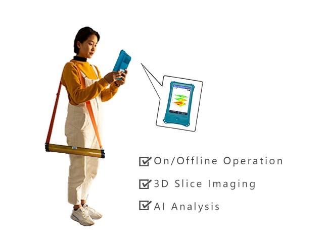
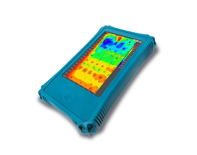
AIDU's water finding Golden Rod is completely wireless and easy to operate with significantly improved accuracy. It features segmented and multi-density scanning to meet specific customer needs. Equipped with AI intelligent analysis, it serves as your 24/7 free online assistant. It can also automatically generate 2D/3D/slice images, providing intuitive view of underground water distributions, making it more scientific for borehole siting decisions
Groundwater Exploration Marvel "Golden Rod"
(New Generation 2024)
R&D Since 1973
6-Month Trade-Up Guarantee
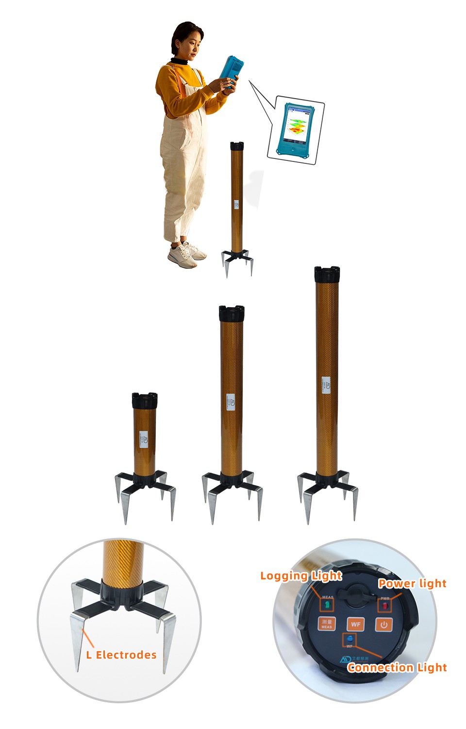
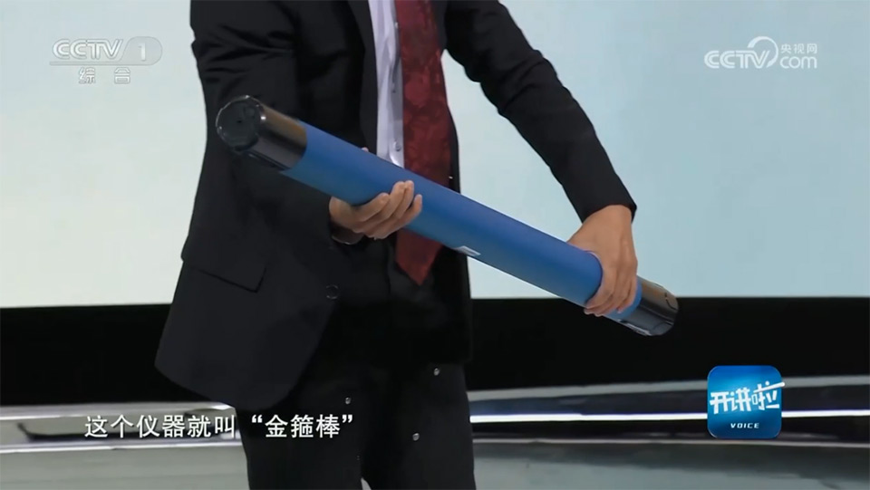
The "Golden Rod", a ground water detector innovatively introduced by AIDU, represents a perfect fusion of the main instrument and electromagnetic sensors . It completely eliminates the traditional constraints of pulling cables and grounding, enabling fully wireless operation. This makes it adaptable to any complex terrain and allows a single person to efficiently complete ground water exploration tasks. Since its debut in 2016, this revolutionary product has quickly gained widespread acclaim in domestic and international hydrogeological exploration, geothermal surveying, and engineering fields due to its "fully wireless, precise, efficient, and easy-to-use" features. It has garnered over 20,000 loyal users worldwide and has been featured multiple times on CCTV News, becoming a star product in the industry.
Now, the Golden Rod has undergone a major upgrade. The new generation of the product retains the original advantages while incorporating advanced technologies that further enhance ground water exploration accuracy and significantly optimize user experience. These upgrades not only provide more reliable results but also help users significantly improve work efficiency and economic benefits, continuing to lead the industry into a new era of intelligence and efficiency.
 Superior Accuracy
  Segmented Scanning
 Scan Density Options
  AI Analysis
Trusted by Millions, CCTV Recommended
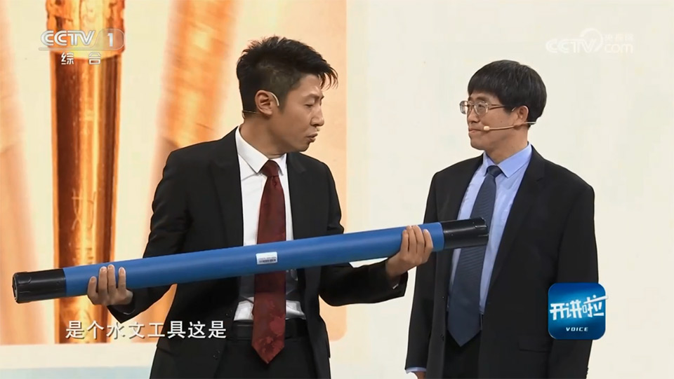
CCTV-1 "Voice" on March 23rd, 2024
Water Finding Marvel "Golden Rod" assisted in the "Three North" Shelterbelt Project
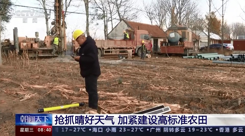
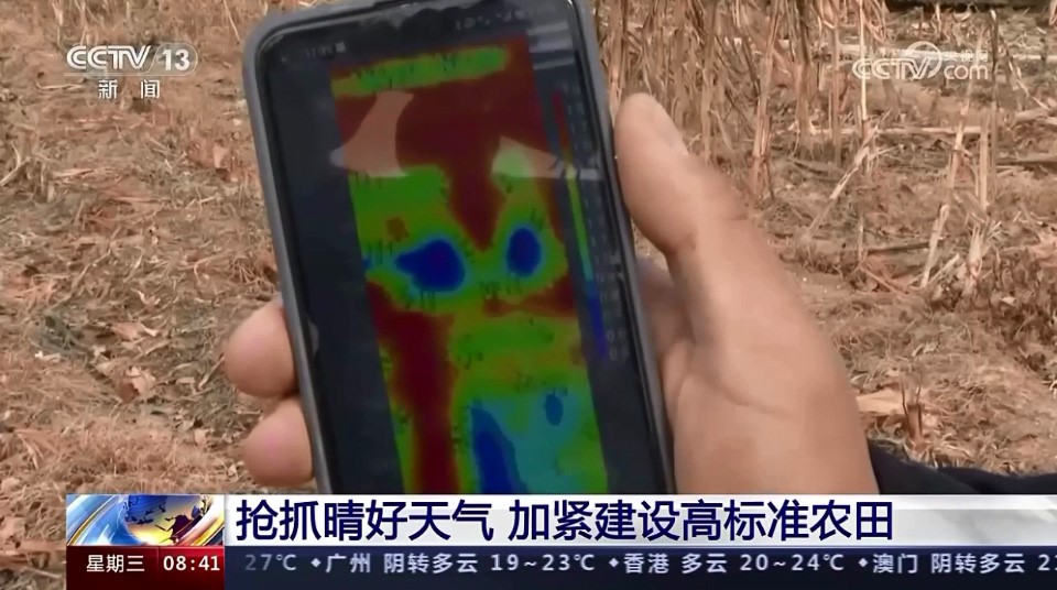
CCTV-13 "Morning News" on November 29th, 2023
It showcased how the "Golden Rod" automatically generates geological images to support farmland construction in Laizhou, Shandong Province
PURPOSES
Primarily Used for Locating Groundwater Position, Depth, and Flow Direction Prior to Drilling
TEN ADVANTAGES
TO HELP YOU EXPLORE WORRY-FREE
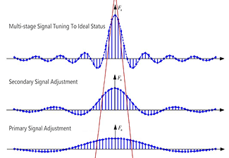 Upgraded Accuracy
The new Golden Rod ground water detector boasts a meticulously designed multi-stage signal conditioning system, achieving unprecedented measurement accuracy and reliability, underpinning your water exploration endeavors.
Upgraded Accuracy
The new Golden Rod ground water detector boasts a meticulously designed multi-stage signal conditioning system, achieving unprecedented measurement accuracy and reliability, underpinning your water exploration endeavors.
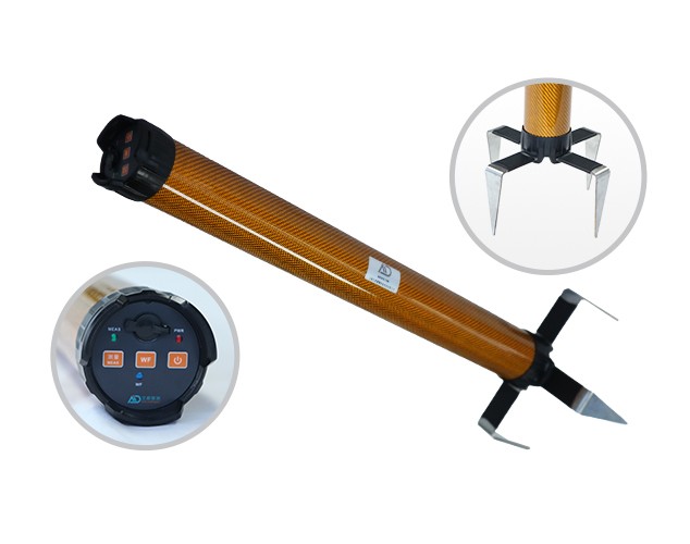
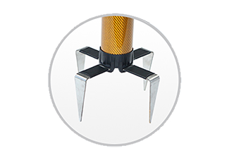 Enhanced Stability
The four-electrode design effectively enhances stability during measurements, ensuring accurate and reliable data
Enhanced Stability
The four-electrode design effectively enhances stability during measurements, ensuring accurate and reliable data
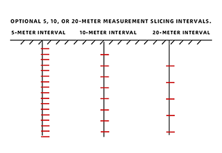 Scan Density Options
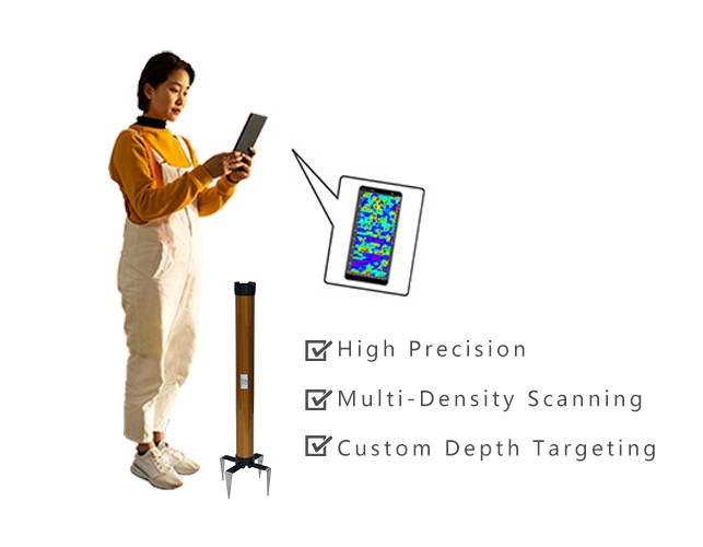
This device offers three scanning density options: 5 meters per layer, 10 meters per layer, and 20 meters per layer. The smaller the interval, the higher the accuracy, though it also increases the measurement time. Users can choose according to their needs: if speed is a priority, select 20 meters per layer; if high precision is required, select 5 meters per layer.
Scan Density Options
This device offers three scanning density options: 5 meters per layer, 10 meters per layer, and 20 meters per layer. The smaller the interval, the higher the accuracy, though it also increases the measurement time. Users can choose according to their needs: if speed is a priority, select 20 meters per layer; if high precision is required, select 5 meters per layer.
 Segmented Measurement
Segmented measurement is an innovative feature allowing users to measure specific depth segments underground. For example, in plateau regions with thick strata, users searching for water resources can begin measurements at 300 meters below the surface, rather than starting at the surface. This significantly reduces operation time. Additionally, for users requiring higher accuracy, a scanning density of 5 meters per layer is available. This approach ensures both speed and precision, making exploration more flexible and efficient, and ultimately catering to diverse individual needs.
Segmented Measurement
Segmented measurement is an innovative feature allowing users to measure specific depth segments underground. For example, in plateau regions with thick strata, users searching for water resources can begin measurements at 300 meters below the surface, rather than starting at the surface. This significantly reduces operation time. Additionally, for users requiring higher accuracy, a scanning density of 5 meters per layer is available. This approach ensures both speed and precision, making exploration more flexible and efficient, and ultimately catering to diverse individual needs.
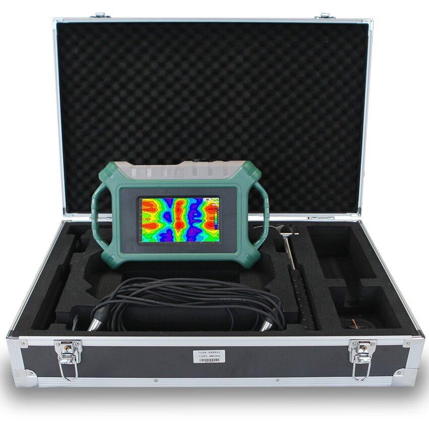
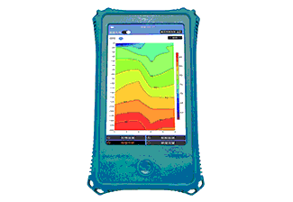 Auto Imaging
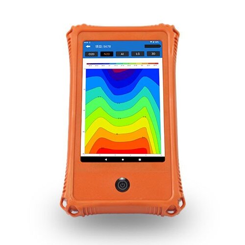
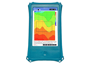
Equipped with the Aidu Water app independently developed by AIDU, it can automatically generate 2D/3D/slice images, making analysis more intuitive and allowing for easy location of ground waters
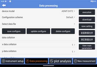 On-Device Data Processing
Without the need for a desktop computer, data denoising, smoothing, and inversion can be easily performed directly on the device. This improves data accuracy and offers significant convenience for geological exploration and water detection
On-Device Data Processing
Without the need for a desktop computer, data denoising, smoothing, and inversion can be easily performed directly on the device. This improves data accuracy and offers significant convenience for geological exploration and water detection
24/7 AI-Powered Auto Analysis
Enjoy round-the-clock, free image analysis support. Our AI continuously learns from user feedback, evolving its accuracy with each use, ensuring increasingly precise drilling decisions
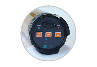 Offline Measurement
Newly introduced offline measurement capability not only enhances user experience but also effectively mitigates the impact of external factors like electromagnetic interference on real-time measurements, resulting in more accurate and reliable outcomes
Offline Measurement
Newly introduced offline measurement capability not only enhances user experience but also effectively mitigates the impact of external factors like electromagnetic interference on real-time measurements, resulting in more accurate and reliable outcomes
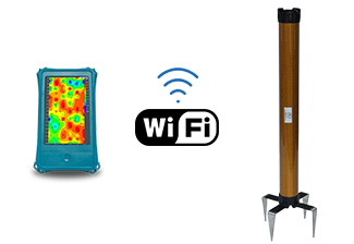 WiFi Networking
The shift to WiFi connectivity has significantly enhanced data transmission efficiency
WiFi Networking
The shift to WiFi connectivity has significantly enhanced data transmission efficiency
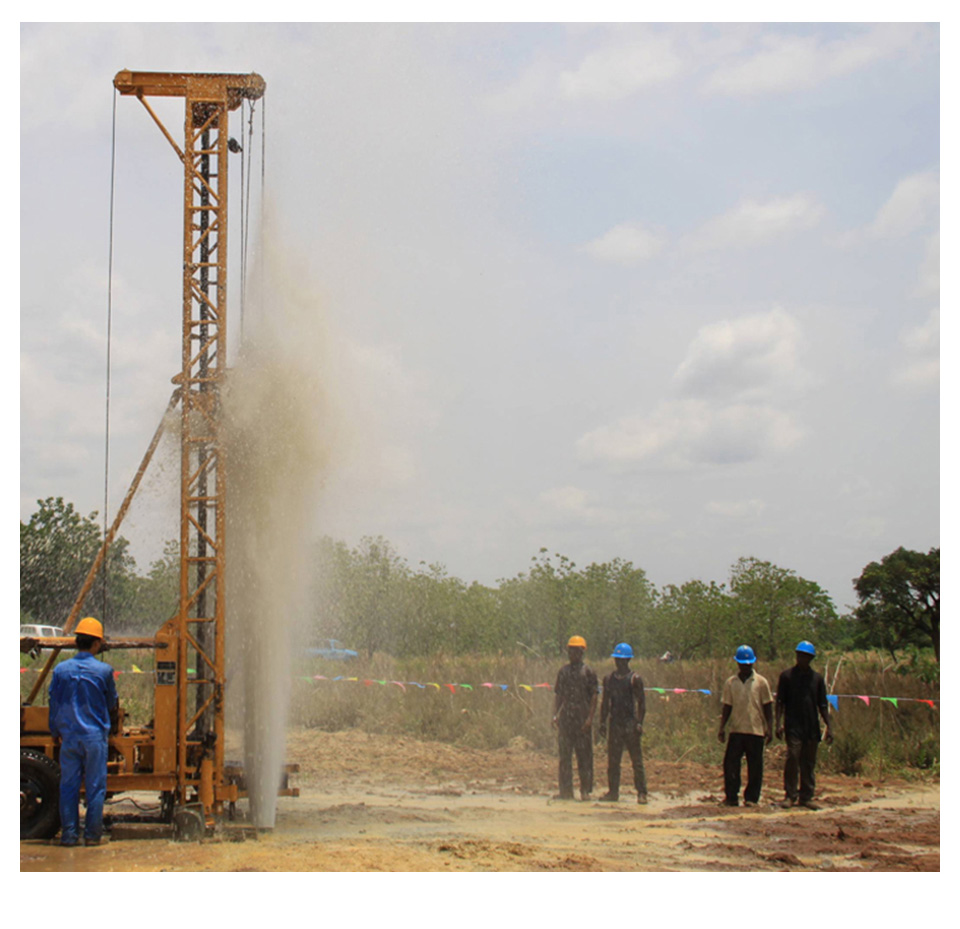
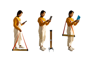 Wireless Operation
The new generation product inherits the advantages of its predecessor, being completely wireless and easy to operate, allowing for single-person use. It can be used for measurements whether placed on the ground, stood upright, or carried on the back, without being limited by ground conditions. Whether in rugged mountainous terrain or complex urban environments, it can handle the task effectively
Wireless Operation
The new generation product inherits the advantages of its predecessor, being completely wireless and easy to operate, allowing for single-person use. It can be used for measurements whether placed on the ground, stood upright, or carried on the back, without being limited by ground conditions. Whether in rugged mountainous terrain or complex urban environments, it can handle the task effectively
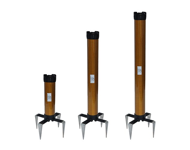
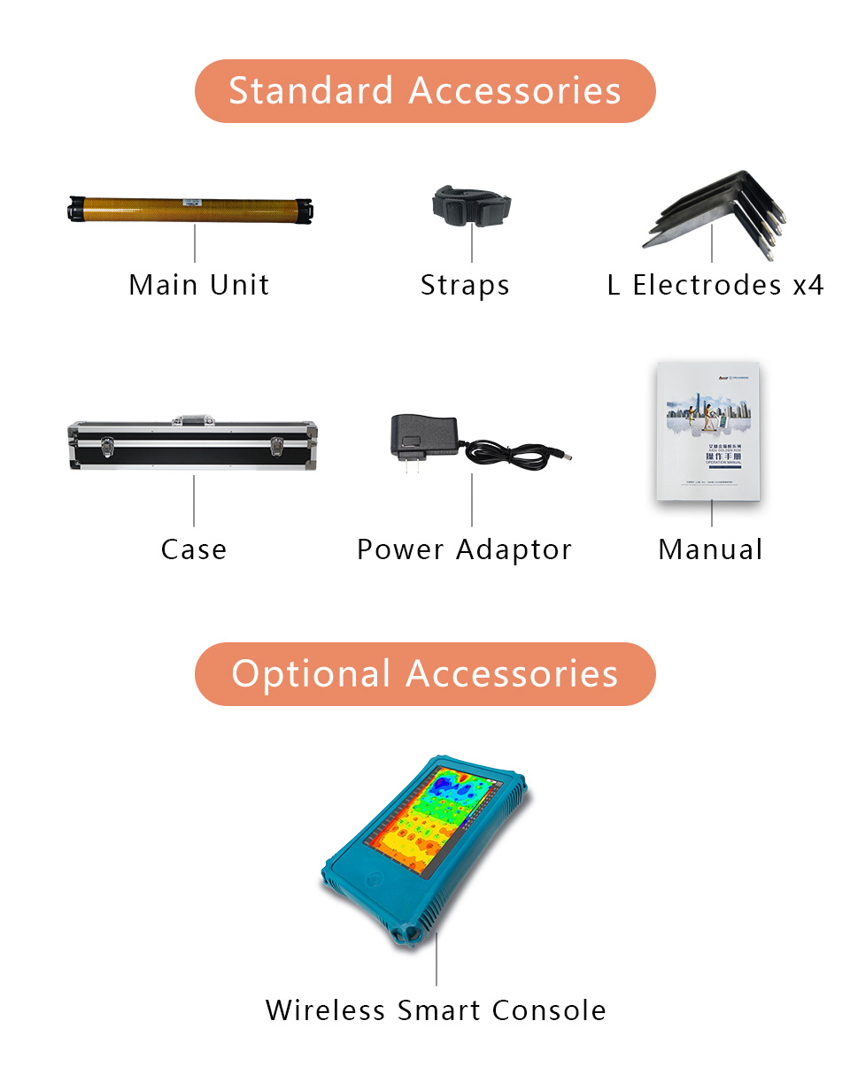
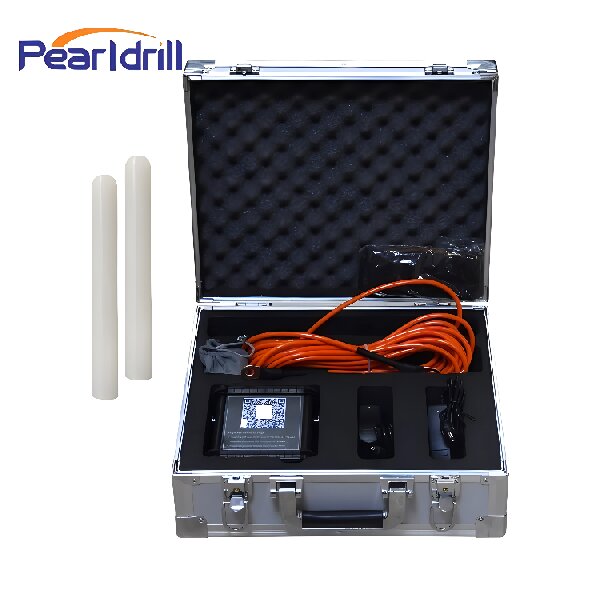
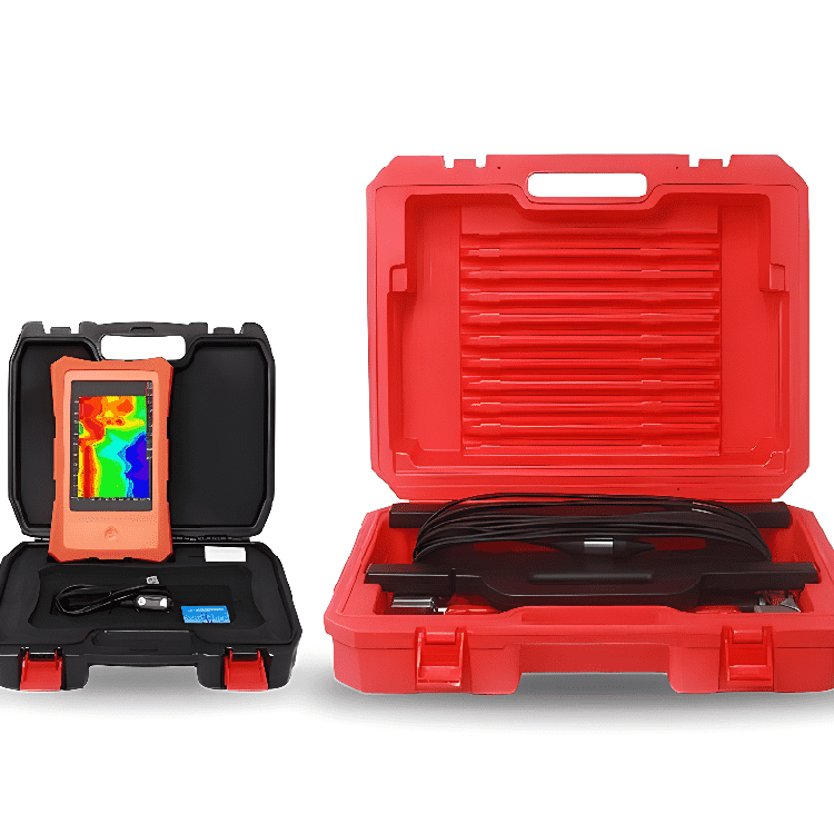
Full Kit
Product design, packaging, or accessories are subject to change due to ongoing improvements. For the most up-to-date information, please contact our service team.
TECHNICAL PARAMETERS
Versions
|
Versions
|
ADMT-3HT2
|
ADMT-3HT3
|
ADMT-8HT2
|
ADMT-8HT3
|
Max Depth (m)
|
300
|
800
|
Scan Interval
|
5/10/20(m)
|
Battery
|
7.4V 2600mAH lithium battery, Power consumption approx. 140mA
|
Connection
|
WIFI, Bluetooth
|
MN Electrodes
|
Four L-shaped alloy electrodes, each with a size of 100*95*30mm
|
Core Features
|
selectable depth sections, variety in scan interval options, auto 2D/3D imaging, AI expert interpretation of image, on/offline operation
|
TT Coil(mm/w)
|
-
|
300/4
|
300/4
|
450/8
|
550/8
|
TT Iron Core(KmH/m)
|
-
|
80
|
100
|
100
|
120
|
Ground Conditions
|
soft ground only
|
all grounds
|
Freq. Range (hz)
|
1-8K
|
Sensing Mode
|
MN
|
MN/TT
|
Discrim.
|
0.1mV±5%
|
0.01mV±1%
|
Acquisition Time (s)
|
14-420
|
14-420
|
14-700
|
14-420
|
14-700
|
Main Unit Weight (kg)
|
0.8
|
1.9
|
2.6
|
Main Unit Size (mm)
|
340*71
|
650*71
|
790*71
|
Shipping Weight(kg)
|
4.0
|
5.6
|
6.5
|
Shipping Size (mm)
|
53*21*18
|
77*21*18
|
92*21*18
|
Customer Cases
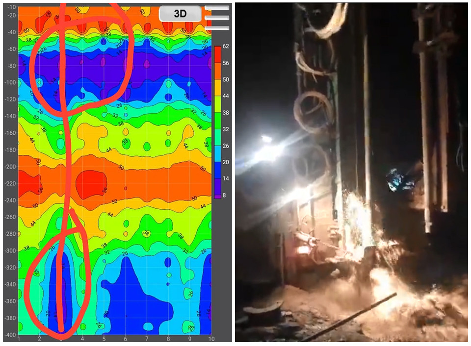
India
Product: Golden-rod Groundwater Detector
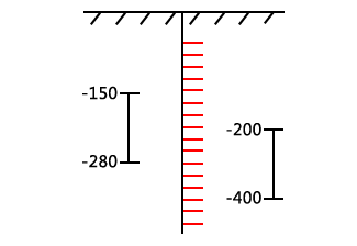
Image Interpretation: The low-resistivity layer at 30m depth may indicate shallow, moist soil in the vadose zone, not necessarily a developed aquifer. The red high-resistivity zone at point 60 is inferred to be a fracture zone or surrounding rock. At 120m, a significant transition from high to low resistivity suggests a sharp increase in water volume. The blue layered low-resistivity zones at 120-150m and 210-300m are inferred to be confined aquifers, potentially with cross-flow recharge between them. It is recommended to drill at position 90, with an expected water outflow at approximately 270m depth.
Actual Drilling Results: The first water flow was encountered around 120m. Continued drilling revealed a significant increase in water volume at approximately 240m, uncovering a confined aquifer with well-developed pores in relatively hard rock. The final drilling depth reached 300m, and the measured results closely matched the predictions.
Trusted by Millions, CCTV Recommended
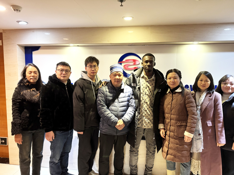
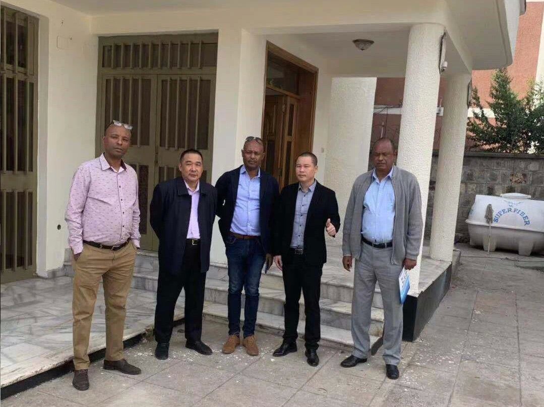
SERVING THE WORLD
QUALIFICATION CERTIFICATE
Certificates and Awards: CE, ISO, China National High-tech Enterprise, China National Technical Invention Patent